Adding Tectonic Plates To Your World Map

,

·

Tectonic Plates are sections of a planet’s lithosphere (the crust and mantle of a planet) that your world continent will then sit upon. They are what separate the land from the molten lava below. Because the lava flows and moves under the surface due to different temperatures in the earth core they slowly move these plates which is what is believed to cause continental drift.

3 Types of Tectonic Movement

 One of the key things to remember about tectonic plates is that they move, but very slowly (up to 3.9 inch per year) and only move in one of the 3 ways as shown by the diagram below:
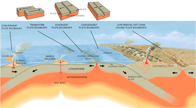
These types of movement will become more important to you later on as you move into drawing other parts of your world map. However I will briefly run over what happens with each movement.

 1 Side to Side

The movement of two plates running next to each other causes earthquakes

2 Moving Away

These plates will cause a continental rift (as shown on the far right of the diagram above)

3 Moving Towards

Plates that move towards each other causes mountain ranges to spring up and quite often volcanic activity.

The movement of tectonic plates will be dealt with in more detail in future articles as you build up the features of your world map.

The Tectonic Plates of Our World

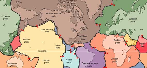
As an example of the size of tectonic plates and the way they cross over continents I’ve included a map of the Earth with the tectonic plates overlaid in different colours. Also this map details the direction a plate is moving from those plates around it. This way you can see a real world example of how plates effect the geography of a continent.
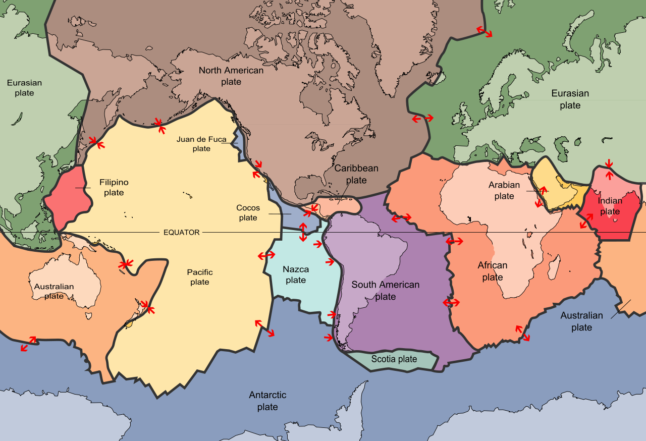
 Earth Tectonic Plates

Adding Tectonic Plates To Your World Map

For this part of the tutorial I’ll be using the island that was created in the “How To Draw Land” article. I’ve also added a second larger island to provide more scope for the world that is being built.

Note: notice how I have mimicked part of the shape of the first island in the second island so it looks like they could have once been joined

Then all you need to do is very simply divided the map up into a number of large plates. The map below has about 8 individual plates.
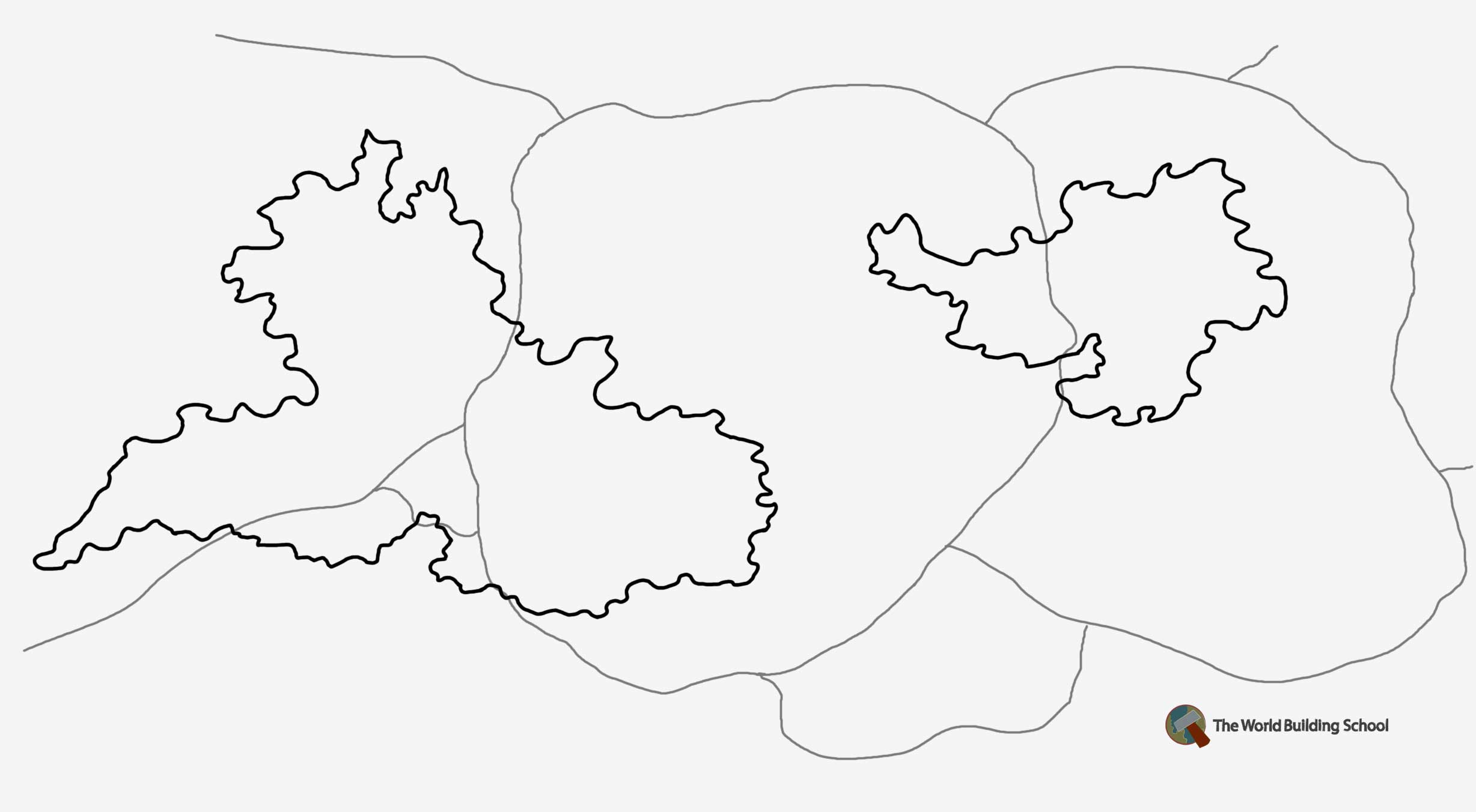
H2DMaps-Tectonic-Plates

The final thing to do is to decide which direction your tectonic plates are moving against each other. Don’t worry if you have a plate who’s edges are all moving in different directions. As you can see from the example below and from the map of the Earth’s tectonics, sometimes a plate grows, shrinks or transforms by having it’s edges move in different directions to each other.

I’ve used red ink to indicate the plate directions but you can use what ever colour you prefer.
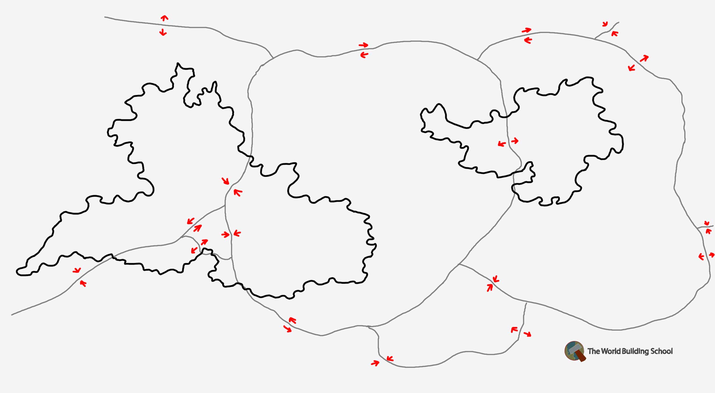
Drawing Tectonic Movement On Your Map

This map is going to have an interesting point of tectonic movement around the center of the big island. I look forward to fleshing out this area and learning more about what lives there. Do you have any interesting points where your plates meet?

Comments

8 responses

  1. […] on from last week’s tutorial on Tectonic plates we’re looking at how the plates affect the landscape of your world and so the environment your […]

  2. Ok, I’m dumb. Where did the two islands once fit together? Is it the coast with the little peninsula on the northeast coast of the big island fitting into the coast with the bay in the southwest coast of the little island? If that’s it, how could they spread apart if they’re on the same plate?

    1. Hey Michael,

      Yea you’re probably right. I did contemplate it myself when first sketching. I probably need to either draw another plate in there somewhere or change the movement of the right side of the plate to expanding.

      Think I’ll also put an oceanic plate in there somewhere. 🙂

  3. Hope you don’t mind me playing with your map, but you could divide that big central plate in half and make the new seam an undersea spreading zone, like the Mid-Atlantic ridge. That way the East side of the big island and the West side of the smaller island could have indeed once been joined together, formed a rift valley, and then split, drifting apart and creating a new ocean with a spreading undersea ridge in the middle.
    Both of the new plates are land plates so when they collided with the other lands, neither of them subducted but rather lifted, forming mountain chains on both islands that run from North to South.
    Anyway, that’s one possibility..

  4. This and the “How To Draw Land” article have been so helpful! I’ve been struggling to create a realistic map for a few months now, but after reading through the first guide and trying it out, voila, realistic looking coast 😀 And to think, I just learned about Tectonic Plates in Physics the other day, and I was feeling like a nerd for trying to incorporate them into my map… Thank you so much for these, this website is a lifesaver ^_^

  5. […] for map making. A good worldbuilding blog World Building School, here are couple of posts Tectonic and Landscaping. I also found this lovely trove of underground cities in history. Think about […]

  6. I found a great library written in C for doing that. A master student wrote it as part of his thesis. If you are interested I created a wrapper in Python for it and used in a complete world generator:

    Plate tectonics simulator:

    https://github.com/ftomassetti/pyplatec

    World generator:

    https://github.com/ftomassetti/lands

    And also a ciivilizations evolution simulator:

    https://github.com/ftomassetti/civs

  7. […] Before I end, I also want to thank Grace (again!) and the people at Worldbuildingschool.com whose tectonic plate tutorial inspired me to add plates to my world. Their tutorial is good, this one just adds a bit more […]

Leave a Reply

Your email address will not be published. Required fields are marked *