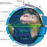
The worlds weather is driven by both the Earth’s rotation and the seasonal variation in solar energy that each hemisphere absorbs. However patterns do form in the weather and they will play an important role for your civilisations, characters lives and the stories you write.
So the next step in building your world is to determine the  direction of your prevailing winds and the currents of your ocean. The technique shown here to determine these two things is a great simplification of what actually happens. However, as a general rule they work quite well to provide a “realistic framework.”
You’ll need to determine where your equator is on the map. If you’re drawing a regional map then it maybe that you can’t see the equator on it. That’s fine, as long as you have an idea if your current map is above or below the equator (if you’re building an Earth like world) then you will still be able to add any currents or winds. Though bear in mind that the full circle of the prevailing wind or oceanic current may be bigger than the map you are drawing. So you may only end up drawing one side of it.
Prevailing Winds
These winds carry moist air from the ocean regions in land and create most of the weather patterns that your characters will experience. From rainy days to monsoons and even cyclones.
Pressure cells of air build up over large bodies of land and sea and out of these cells come the prevailing winds. As a general rule of thumb the winds will travel in a clockwise motion in the northern hemisphere and an anti-clockwise motion in the southern hemisphere.
I’ve marked these on the map below to give you an example:
I’m sure many meteorologists would turn in their grave if they were to look at my map above. However, as stated at the beginning, this is only a very simple technique used to give you a quick idea of which direction the wind will be blowing in when your character steps out into the big wide world you’ve created for them.
Oceanic Currents
The main thing ocean currents do, apart from move sunken ships, is to carry warm water from the equatorial regions out towards the polar regions and carry cold water back. The gulf stream is a good example of this on Earth. It carries warm water from the equator and passes past Britain up to the north pole. This is one of the reasons why Britain is slightly warmer than other locations on a similar longitude.
Again as with the prevailing winds if you have an ocean or sea in the northern hemisphere then the currents will move clockwise, and if you have any in the southern hemisphere they will move anti-clockwise.
It’s most likely you will have a sea that spans both northern and southern hemisphere. In this case just divide the sea by the equator.
Final State Of Your World Map
If you’ve followed all of the previous tutorials on drawing your world map then you should now be at the stage where you have a pretty good idea of how your world looks and the forces that are working upon it to create natural disasters and weather patterns.
There is still a lot more for you to do with your world. You’re not finished yet, so don’t go away. The World Building School is delving deeper into the art of world building and we’ll guide you every step of the way.


